C. H. Ostenfeld Glacier
C. H. Ostenfeld Glacier (Danish: C. H. Ostenfeld Gletscher), is one of the major glaciers in northern Greenland.[1]
| C. H. Ostenfeld Glacier | |
|---|---|
| C. H. Ostenfeld Gletscher | |
 Location within Greenland | |
| Type | Tidal outlet glacier |
| Location | Greenland |
| Coordinates | 81°43′00″N 44°10′00″W |
| Length | 50 km (31 mi) |
| Width | 8 km (5.0 mi) |
| Thickness | 93 m (305 ft) |
| Terminus | Victoria Fjord; Lincoln Sea |
This glacier was first mapped by Lauge Koch in 1917 during Knud Rasmussen's 1916-1918 Second Thule Expedition to north Greenland and was named after Danish botanist Carl Hansen Ostenfeld (1873–1931), author of Flora of Greenland and its origin.[2]
Geography
The C. H. Ostenfeld Glacier originates in the Greenland Ice Cap. It is roughly southeast–northwest oriented and has its terminus at the head of Victoria Fjord.[3] There are three nunataks near its terminus. The glacier's last stretch is a floating tongue within the fjord. The Brikkerne Glacier joins from the right near the head of the fjord.[4]
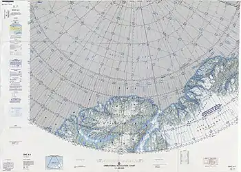 Map of part of Ellesmere Island and far Northern Greenland. |
Bibliography
See also
References
- Contribution to the glaciology of northern Greenland - UCI ESS
- Ostenfeld, C.H. (1926). "The flora of Greenland and its origin". Biologiske Meddelelser, Kongelige Danske Videnskabernes Selskab. 6: 1–71.
- "C. H. Ostenfeld Gletscher". Mapcarta. Retrieved 15 March 2019.
- U.S. Geological Survey Professional Paper, Volume 1386, Part 3, figure 38
External links
This article is issued from Wikipedia. The text is licensed under Creative Commons - Attribution - Sharealike. Additional terms may apply for the media files.