Mount Onnebetsu
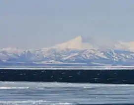
Mount Onnebetsu (遠音別岳, Onnebetsu-dake) is a Quaternary stratovolcano.[2] Its summit is 1,330.2 metres (4,364 ft) above sea level.[1] It is located on Hokkaido's Shiretoko Peninsula on the border of Shari in Shari District, Abashiri and Rausu in Menashi District, Nemuro.
| Mount Onnebetsu | |
|---|---|
| 遠音別岳 | |
 Mount Onnebetsu | |
| Highest point | |
| Elevation | 1,330.2 m (4,364 ft)[1] |
| Listing | List of mountains and hills of Japan by height |
| Coordinates | 43°59′36″N 145°0′48″E[1] |
| Geography | |
 Mount Onnebetsu Location of Mount Onnebetsu in Japan. | |
| Location | Hokkaido, Japan |
| Parent range | Shiretoko Peninsula |
| Topo map | Geospatial Information Authority 25000:1 遠音別岳 25000:1 真鯉 50000:1 斜里 50000:1 標津 |
| Geology | |
| Age of rock | Quaternary |
| Mountain type | Stratovolcano and Lava dome |
| Volcanic arc/belt | Kurile arc |
| Last eruption | ca. 0.4-0.2 million years ago |
References
- Geospatial Information Authority topographical map 遠音別岳
- "ONNEBETSU-DAKE". Quaternary Volcanoes in Japan. Geological Survey of Japan, AIST. 26 August 2008. Archived from the original on December 19, 2012. Retrieved 5 May 2010.
External links
- "Onnebetsu". Global Volcanism Program. Smithsonian Institution. Retrieved 2021-06-25.
This article is issued from Wikipedia. The text is licensed under Creative Commons - Attribution - Sharealike. Additional terms may apply for the media files.