Nefasit
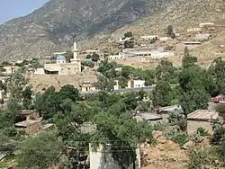
Nefasit (Arabic: نفاسيت, Tigrinya: ነፋሲት Tigrinya pronunciation: [nɐfasit]), also known as Tappa Nefasit, is a small town in the Northern Red Sea Region of Eritrea. Monastery of Debre Bizen is located at the mountains above.
Nefasit
نفاسيت | |
|---|---|
Town | |
 | |
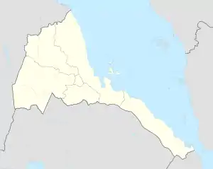 Nefasit Location in Eritrea | |
| Coordinates: 15°20′00″N 39°03′43″E | |
| Country | |
| Region | Northern Red Sea |
| District | Ghinda |
| Elevation | 1,700 m (5,500 ft) |
| Population (2005) | |
| • Total | 8,727 |
| Climate | Cfa |
According to multiple tour groups the stretch between the capital Asmara and Nefasit is the most beautiful in Eritrea. There's a colonial era Italian railway that occasionally runs from Asmara.
Climate
| Climate data for Nefasit | |||||||||||||
|---|---|---|---|---|---|---|---|---|---|---|---|---|---|
| Month | Jan | Feb | Mar | Apr | May | Jun | Jul | Aug | Sep | Oct | Nov | Dec | Year |
| Average high °C (°F) | 25.1 (77.2) |
26.0 (78.8) |
27.5 (81.5) |
28.6 (83.5) |
29.7 (85.5) |
30.3 (86.5) |
27.0 (80.6) |
26.7 (80.1) |
28.5 (83.3) |
27.5 (81.5) |
25.6 (78.1) |
24.7 (76.5) |
27.3 (81.1) |
| Average low °C (°F) | 8.9 (48.0) |
9.6 (49.3) |
11.1 (52.0) |
12.7 (54.9) |
14.5 (58.1) |
16.8 (62.2) |
16.6 (61.9) |
17.3 (63.1) |
15.6 (60.1) |
12.8 (55.0) |
10.6 (51.1) |
9.5 (49.1) |
13.0 (55.4) |
| Average precipitation mm (inches) | 65 (2.6) |
71 (2.8) |
48 (1.9) |
54 (2.1) |
41 (1.6) |
26 (1.0) |
125 (4.9) |
126 (5.0) |
39 (1.5) |
58 (2.3) |
45 (1.8) |
68 (2.7) |
766 (30.2) |
| Source: Climate Data | |||||||||||||
This article is issued from Wikipedia. The text is licensed under Creative Commons - Attribution - Sharealike. Additional terms may apply for the media files.