Panchthar District
Panchthar District (Nepali: पाँचथर जिल्लाⓘ) is one of 14 districts of Koshi Province of eastern hilly region of Nepal. It is a Hill district of eastern Nepal. The district covers 1,241 km2 (479 sq mi) of area. The 2011 census counted 191,817 population. Phidim is the district headquarters.
Panchthar District
पाँचथर जिल्ला | |
|---|---|
 Location of Panchthar district | |
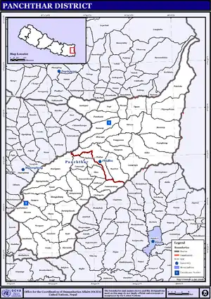
 Divisional map of Panchthar district | |
| Country | |
| Province | Koshi Province |
| Admin HQ. | Phidim |
| Government | |
| • Type | Coordination committee |
| • Body | DCC, Panchthar |
| Area | |
| • Total | 1,241 km2 (479 sq mi) |
| Population (2011[1]) | |
| • Total | 191,817 |
| • Density | 150/km2 (400/sq mi) |
| Time zone | UTC+05:45 (NPT) |
History
Panchthar was a part of Old Dhankuta District during Rana era and until 1962. Dhankuta district had two subdivisions Chhathum and Tehrathum. Panchthar was a thum (county) under the Terhathum subvision. It became a separate district in 1962 when the old 32 traditional districts divided into 75 district.
Geography and climate
| Climate Zone[2] | Elevation Range | % of Area |
|---|---|---|
| Upper Tropical | 300 to 1,000 meters 1,000 to 3,300 ft. |
18.3% |
| Subtropical | 1,000 to 2,000 meters 3,300 to 6,600 ft. |
52.6% |
| Temperate | 2,000 to 3,000 meters 6,400 to 9,800 ft. |
23.9% |
| Subalpine | 3,000 to 4,000 meters 9,800 to 13,100 ft. |
4.7% |
| Alpine | 4,000 to 5,000 meters 13,100 to 16,400 ft. |
0.4% |
Demographics
| Year | Pop. | ±% p.a. |
|---|---|---|
| 1981 | 153,746 | — |
| 1991 | 175,206 | +1.32% |
| 2001 | 202,056 | +1.44% |
| 2011 | 191,817 | −0.52% |
| 2021 | 174,419 | −0.95% |
| Sources:[3] | ||
At the time of the 2011 Nepal census, Panchthar District had a population of 191,817.
As their first language, 40.3% spoke Limbu, 33.9% Nepali, 6.5% Tamang, 5.5% Bantawa, 5.3% Rai, 2.9% Magar, 1.1% Gurung, 0.7% Chamling, 0.7% Sunuwar, 0.5% Newar, 0.3% Maithili, 0.3% Sampang, 0.3% Sherpa, 0.3% Yakkha, 0.2% Khaling, 0.2% Thulung, 0.1% Bhojpuri, 0.1% Nachhiring and 0.2% other languages.[5]
Ethnicity/caste: 42.1% were Limbu, 13.8% Rai, 10.8% Hill Brahmin, 9.7% Chhetri, 7.1% Tamang, 3.4% Kami, 3.3% Magar, 2.2% Damai/Dholi, 1.9% Gurung, 1.4% Newar, 1.0% Sunuwar, 0.5% Sanyasi/Dasnami, 0.5% Sarki, 0.4% Sherpa, 0.3% Majhi, 0.3% Yakkha, 0.2% Gharti/Bhujel, 0.1% other Dalit, 0.1% Samgpang, 0.1% Teli and 0.4% others.[6]
Religion: 52.0% were Kirati, 34.3% Hindu, 11.7% Buddhist, 1.6% Christian, 0.1% Prakriti and 0.2% others.[8]
Literacy: 72.4% could read and write, 3.2% could only read and 24.4% could neither read nor write.[9]
Municipality and Rural Municipalities of Panchthar
- Phidim Municipality Nepali: फिदिम नगरपालिका (Phidim Municipality, Ranitar, Lumphabung, Yangnam(1-5), Nangin, Lungrupa)
- Hilihang Rural Municipality Nepali: हिलिहाङ गाउँपालिका (Ambarpur, Panchami, Subhang, Bharapa)
- Kummayak Rural Municipality Nepali: कुम्मायाक गाउँपालिका (Yasok, Rani Gaun, Mangjabung, Syabarumba)
- Miklajung Rural Municipality Nepali: मिक्लाजुंग गाउँपालिका (Aarubote, Sarangdanda, Rabi, Kurumba, Limba, Durdimba)
- Phalelung Rural Municipality (Nepali: फालेलुंग गाउँपालिका (Ektin, Memeng, Prangbung, Yangnam(6,9) Sidin)
- Phalgunanda Rural Municipality (Nepali: फाल्गुनन्द गाउँपालिका (Nawamidanda, Imbung, Pauwa Sartap, Chilingdin, Aangsarang, Phaktep)
- Tumbewa Rural Municipality Nepali: तुम्वेवा गाउँपालिका (Aangna, Olane, Hangum, Mauwa)
- Yangawarak Rural Municipality Nepali: याङवरक गाउँपालिका (Chyangthapu, Phalaicha, Oyam, Tharpu, Nagi)
VDC's in small brackets means they are combined to form main Rural Municipality
Previous Village Development Committees (VDCs) and Municipalities
- Aangna
- Aangsarang
- Ambarpur
- Bharapa
- Chilingdin
- Chyangthapu
- Durdimba
- Ektin
- Embung
- Phalaicha
- Hangum
- Kurumba
- Limba
- Lungrupa
- Mangjabung
- Mauwa
- Memeng
- Nagi
- Nangin
- Nawamidanda
- Olane
- Oyam
- Panchami
- Prangbung
- Pauwa Sartap
- Phaktep
- Phidim Municipality
- Prangbung
- Rabi
- Rani Gaun
- Ranitar
- Sarangdanda
- Sidin
- Subhang
- Syabarumba
- Tharpu
- Yangnam
- Yasok
- lumphabung
- sarangdada
- phaktep
People from Panchthar District
See also
References
- Household and population by districts, Central Bureau of Statistics (CBS) Nepal Archived 2013-07-31 at the Wayback Machine
- The Map of Potential Vegetation of Nepal - a forestry/agroecological/biodiversity classification system (PDF), Forest & Landscape Development and Environment Series 2-2005 and CFC-TIS Document Series No.110., 2005, ISBN 87-7903-210-9, retrieved Nov 22, 2013
- "Nepal: Provinces and Districts". www.citypopulation.de.
- "NepalMap profile: Panchthar". NepalMap. Retrieved 17 July 2022.
- NepalMap Language
- NepalMap Caste
- "NepalMap profile: Panchthar". NepalMap. Retrieved 17 July 2022.
- NepalMap Religion
- NepalMap Literacy
External links
- "Districts of Nepal". Statoids.
Places adjacent to Panchthar District | ||||||||||||||||
|---|---|---|---|---|---|---|---|---|---|---|---|---|---|---|---|---|
| ||||||||||||||||