Redpath, Scottish Borders
Redpath (Scots: Rippath[2]) is a small village located between the larger settlements of Earlston, 2 miles (3.2 km) to the north, and St Boswells, 3 miles (4.8 km) to the south, in the historic county of Berwickshire within the Scottish Borders. The Leader Water runs past the west end of the village.
Redpath
| |
|---|---|
.jpg.webp) Village entrance | |
 Redpath Location within the Scottish Borders | |
| Population | 56 (2001)[1] |
| OS grid reference | NT583357 |
| • Edinburgh | 31 mi (50 km) NW |
| Civil parish |
|
| Community council |
|
| Council area | |
| Lieutenancy area | |
| Country | Scotland |
| Sovereign state | United Kingdom |
| Post town | EARLSTON |
| Postcode district | TD4 |
| Dialling code | 01896 |
| Police | Scotland |
| Fire | Scottish |
| Ambulance | Scottish |
| UK Parliament | |
| Scottish Parliament | |
Gallery
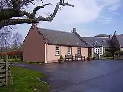 Redpath Village Hall
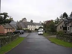 Redpath Village
.jpg.webp) Leader Water outside Redpath
Leader Water outside Redpath Redpath Hill
References
- Local Development Plan Volume 2 (Report). Scottish Borders Council. 2016. pp. 463–465.
- "Rippath". Dictionary of the Scots Language. Scottish Language Dictionaries Ltd. 2004. Retrieved 26 December 2021.
This article is issued from Wikipedia. The text is licensed under Creative Commons - Attribution - Sharealike. Additional terms may apply for the media files.