Assis Brasil
Assis Brasil (Portuguese pronunciation: [aˈsiz bɾaˈziw]) is a municipality located in the south of the Brazilian state of Acre. Its population is 7,534 (2020 est) and its area is 4,974 square kilometres (1,920 sq mi).
Assis Brasil | |
|---|---|
 | |
 Flag  Seal | |
 Location of municipality in Acre State | |
 Assis Brasil Location in Brazil | |
| Coordinates: 10°56′27″S 69°34′01″W 10°56′27″S 69°34′01″W | |
| Country | |
| State | Acre |
| Government | |
| • Mayor | Antonio Barbosa de Sousa (PSDB) |
| Area | |
| • Total | 4,974 km2 (1,920 sq mi) |
| Population (2020 est) | |
| • Total | 7,534 |
| Time zone | UTC−5 (ACT) |
The municipality contains part of the Rio Acre Ecological Station.[1] It also contains part of the 931,537 hectares (2,301,880 acres) Chico Mendes Extractive Reserve, a sustainable use environmental unit created in 1990.[2]
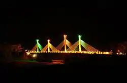
It is located near the Brazil–Peru Integration Bridge.
Name
The municipality was named after Joaquim Francisco de Assis Brasil, a diplomat who was involved in the transference of Acre from Bolivian to Brazilian control after the Acre War.
Towns and villages
- Abismo
- Assis Brasil - capital
- Maloca
- Reserva Extrema
- São Francisco, Acre
- Senegal, Acre
- Seringal Paraguacu
References
- Unidade de Conservação: Estação Ecológica Rio Acre (in Portuguese), MMA: Ministério do Meio Ambiente, retrieved 2016-04-23
- Unidade de Conservação: Reserva Extrativista Chico Mendes (in Portuguese), MMA: Ministério do Meio Ambiente, retrieved 2016-06-04

This article is issued from Wikipedia. The text is licensed under Creative Commons - Attribution - Sharealike. Additional terms may apply for the media files.