Cattenbroek
Cattenbroek is a hamlet in the Dutch province of Utrecht. It is a part of the municipality of Montfoort, and lies about 4 km east of Woerden.
Cattenbroek | |
|---|---|
Hamlet | |
 Cattenbroekerdijk (dike) | |
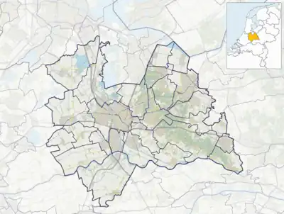 Cattenbroek Location in the Netherlands  Cattenbroek Cattenbroek (Netherlands) | |
| Coordinates: 52°3′50″N 4°56′20″E | |
| Country | Netherlands |
| Province | Utrecht |
| Municipality | Montfoort |
| Area | |
| • Total | 4.16 km2 (1.61 sq mi) |
| Population (2021)[1] | |
| • Total | 85 |
| • Density | 20/km2 (53/sq mi) |
| Time zone | UTC+1 (CET) |
| • Summer (DST) | UTC+2 (CEST) |
| Postal code | 3461[1] |
| Dialing code | 0348 |
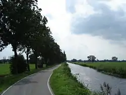
The hamlet was first mentioned in 1217 as Cattenbroec, and means inferior swampy land.[2] The postal authorities have placed it under Linschoten.[3] Cattenbroek does not have place name signs. In 1840, it was home to 75 people. There is a public beach on the lake near Cattenbroek.[4]
Gallery
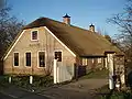 Farm in Cattenbroek
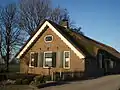 Farm Helena in Cattenbroek
 Drawing of inn De Lindeboom (1729)
 Lake and beach near Cattenbroek
References
- "Kerncijfers wijken en buurten 2021". Central Bureau of Statistics. Retrieved 28 March 2022.
- "Cattenbroek - (geografische naam)". Etymologiebank (in Dutch). Retrieved 28 March 2022.
- "Postcode 3461 in Linschoten". Postcode bij adres (in Dutch). Retrieved 28 March 2022.
- "Cattenbroek". Plaatsengids (in Dutch). Retrieved 28 March 2022.
Wikimedia Commons has media related to Cattenbroek.
This article is issued from Wikipedia. The text is licensed under Creative Commons - Attribution - Sharealike. Additional terms may apply for the media files.