Drahovce
Drahovce (Hungarian: Vágdebrőd) is a village and municipality in Piešťany District in the Trnava Region of western Slovakia.
Drahovce | |
|---|---|
Municipality | |
 Coat of arms | |
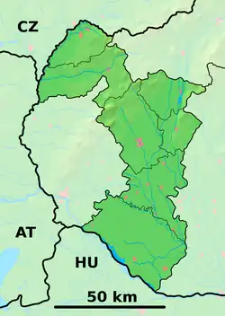 Drahovce Location of Drahovce in the Trnava Region  Drahovce Drahovce (Slovakia) | |
| Coordinates: 48°31′N 17°48′E | |
| Country | Slovakia |
| Region | Trnava |
| District | Piešťany |
| First mentioned | 1309 |
| Area | |
| • Total | 24.04[1] km2 (9.28[1] sq mi) |
| Elevation | 150[2] m (490[2] ft) |
| Population (2021) | |
| • Total | 2,608[3] |
| Postal code | 922 41[2] |
| Area code | +421 33[2] |
| Car plate | PN |
| Website | obecdrahovce.sk |
History
In historical records the village was first mentioned in 1309.
Geography
The municipality lies at an altitude of 150 metres and covers an area of 24.042 km2. It has a population of about 2587 people.
Genealogical resources
The records for genealogical research are available at the state archive "Statny Archiv in Bratislava, Slovakia"
- Roman Catholic church records (births/marriages/deaths): 1787-1907 (parish A)
References
- "Hustota obyvateľstva - obce [om7014rr_ukaz: Rozloha (Štvorcový meter)]". www.statistics.sk (in Slovak). Statistical Office of the Slovak Republic. 2022-03-31. Retrieved 2022-03-31.
- "Základná charakteristika". www.statistics.sk (in Slovak). Statistical Office of the Slovak Republic. 2015-04-17. Retrieved 2022-03-31.
- "Počet obyvateľov podľa pohlavia - obce (ročne)". www.statistics.sk (in Slovak). Statistical Office of the Slovak Republic. 2022-03-31. Retrieved 2022-03-31.
External links
- https://web.archive.org/web/20071116010355/http://www.statistics.sk/mosmis/eng/run.html
- Surnames of living people in Drahovce
Municipalities of Piešťany District | ||
|---|---|---|
This article is issued from Wikipedia. The text is licensed under Creative Commons - Attribution - Sharealike. Additional terms may apply for the media files.