Espinar Province
Espinar Province is one of thirteen provinces in the Cusco Region in the southern highlands of Peru.
Espinar | |
|---|---|
 K'anamarka in the Espinar Province | |
 Flag | |
 Location of Espinar in the Cusco Region | |
| Country | Peru |
| Region | Cusco |
| Capital | Yauri |
| Government | |
| • Mayor | Lindley Alfredo Salinas Perez (2007) |
| Area | |
| • Total | 5,311.09 km2 (2,050.62 sq mi) |
| Population (2005 census) | |
| • Total | 66,908 |
| • Density | 13/km2 (33/sq mi) |
| UBIGEO | 0808 |
Geography
Some of the highest mountains of the province are listed below:[1][2]
- Allqamarini
- Akillani
- Anta Anta
- Anta Qullu
- Apachita
- Aqhu Phichaqa
- Atawallpa
- Atawallpa Much'u
- Chunkara Qaqa
- Chuqi Pirwa (Are.-Cusco)
- Chuqi Pirwa (Cusco-Puno)
- Ch'iyar Jaqhi
- Ch'iyara
- Ch'uwañuma
- Hatun Chhuka
- Huch'uy Mut'u
- Isankani
- Janq'u
- Janq'u Q'awa
- Japu Apachita
- Jichu Qullu
- Kimsa Chata
- Kiswarani Q'asa
- Kuntur Sayana
- Kuntur Uma
- Kunturi
- Laramani
- Machu Kunturuma
- Misa Urqu
- Mut'u
- Muyu Qaqa
- Pawsa Urqu
- Pilluni
- Puka Nasa
- Puka Puka
- Puka Punchu
- Puka Q'asa
- Pukara
- Pumanuta
- Qaqa Urqu
- Qullpa Pata
- Qullqi Q'awa
- Q'ara Qullu
- Q'atawini
- Salla
- Salla Saywa
- Siq'i Urqu
- Sura Quta
- Sura Urqu
- Sura Uma
- Tarujani
- Taypi Tira
- Urqu K'uchu
- Uturunku Pata
- Wallqa
- Waman Wachana
- Wanu Wanu
- Waylla Apachita
- Waylla Tira
- Waylluma
- Wayna Sinqa
- Wila Wila
- Wiska Apachita
- Yana Qaqa
- Yana Urqu
- Yuraq Q'asa
- Yuraq Sunquyuq
Political division
The province is divided into eight districts (Spanish: distritos, singular: distrito), each of which is headed by a mayor (alcalde). The districts, with their capitals in parentheses, are:
- Alto Pichigua (Accocunca)
- Condoroma (Condoroma)
- Coporaque (Coporaque)
- Espinar (Yauri)
- Ocoruro (Ocoruro)
- Pallpata (Hector Tejada)
- Pichigua (Pichigua)
- Suykutambo (Suykutambo)
History
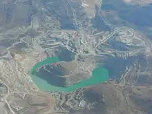
On 21 May 2012, agricultural leadership in Espinar Province announced a strike against the planned expansion of Tintaya mine, a copper mine owned by the Swiss corporation Xstrata. The leaders' demands included higher environmental standards, more money for area development, and independent oversight of the mine.[3] Strikers occupied the roads to the mine over the following week, blocking all access. In response, President Ollanta Humala declared a state of emergency in the province, suspending constitutional rights,[4] and deployed police commandos against the strikers.[3] Two civilians were killed in the resulting clashes, and seventy police officers were injured.[4] On 30 May, provincial mayor Oscar Mollohuanca was arrested by the national government and accused of inciting protests against an expansion of a copper mine owned by Xstrata.[5] He was conditionally released on 13 July.[3]
Ethnic groups
The people in the province are mainly indigenous citizens of Quechua descent. Quechua is the language which the majority of the population (68.90%) learnt to speak in childhood, 30.75% of the residents started speaking in Spanish (2007 Peru Census).[6]
See also
References
- escale.minedu.gob.pe - UGEL map of the Espinar Province (Cusco Region)
- Peru 1:100,000, Condoroma 2640, Map prepared and published by the Defense Mapping Agency, Hydrographic/Topographic Center, Bethesda, MD
- Stephanie Boyd (18 June 2012). "Peru's great transformation". Al Jazeera. Retrieved 26 June 2012.
- "Peru police arrest mayor who led mine protests". The Los Angeles Times. 30 May 2012. Retrieved 26 June 2012.
- "Peru: Espinar protest mayor in 'preventative' detention". BBC News. 2 June 2012. Retrieved 26 June 2012.
- inei.gob.pe Archived January 27, 2013, at the Wayback Machine INEI, Peru, Censos Nacionales 2007
| |
|---|---|