Handeni Town Council, Tanga
Handeni Town Council also known as Handeni Urban District is one of the 11 districts of the Tanga Region of Tanzania.[2][3] The district covers an area of 837.4 km2 (323.3 sq mi).[4] The administrative capital of the district is Mdoe. Handeni Town District is bordered to the east by Handeni District and the west by Kilindi District.
Handeni Mjini
| |
|---|---|
| Wilaya ya Handeni Mjini, Mkoa wa Tanga | |
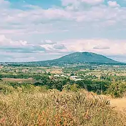 View of Handeni Town from Kwediyamba Ward, Handeni Urban | |
| Nickname: Tanga's magicland | |
 Handeni Town in Tanga 2022 | |
| Coordinates: 5°25′24.96″S 38°1′33.96″E | |
| Country | |
| Region | Tanga Region |
| Area | |
| • District | 837.4 km2 (323.3 sq mi) |
| Population (2022 census)[1] | |
| • District | 108,968 |
| • Density | 130/km2 (340/sq mi) |
| • Urban | 108,968 |
| Demonym | Town Handenian |
| Ethnic groups | |
| • Settler | Swahili |
| • Ancestral | Zigula |
| Website | handenitc |
Administrative subdivisions
As of 2012, Handeni Town Council was administratively divided into 12 wards.[5]
Transport
A paved secondary road connects Handeni with Korogwe in the northeast and Mkata in the southeast; both Korogwe and Mkata are on the T2 Trunk road from Dar es Salaam to Arusha.[6]
References
- Citypopulation.de
- Population Distribution by Administrative Units, United Republic of Tanzania, 2013 Archived 2013-05-02 at the Wayback Machine
- "Tanzania: Administrative Division". City Population. Retrieved December 29, 2018.
- "Tanzania: Northern Zone(Districts and Wards) - Population Statistics, Charts and Map".
- "2012 Population and Housing Census" (PDF). Development Partners Group Tanzania. Retrieved 7 August 2019.
- "Tanga Region Roads Network" (PDF). Tanroads. Retrieved 8 August 2019.
This article is issued from Wikipedia. The text is licensed under Creative Commons - Attribution - Sharealike. Additional terms may apply for the media files.