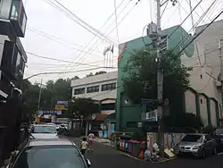
Hapjeong-dong
Hapjeong-dong (Korean pronunciation: [hapt͈ɕʌŋdoŋ]) is a dong, neighbourhood of the Mapo-gu district in Seoul, South Korea.[1][2]
Hapjeong-dong | |
|---|---|
| Korean transcription(s) | |
| • Hangul | 합정동 |
| • Hanja | 合井洞 |
| • Revised Romanization | Hapjeong-dong |
| • McCune–Reischauer | Hap chong dong |
 Hapjeong-dong Community Service Center | |
| Country | South Korea |
| Region | Sudogwon |
| Area | |
| • Total | 1.71 km2 (0.66 sq mi) |
| Population (2001)[1] | |
| • Total | 23,408 |
| • Density | 14,000/km2 (35,000/sq mi) |
Origin of the name
Originally, Hapjeong-dong was a part of Yeonhui-bang, a division of Seoul that encompassed approximately Seodaemun-gu and the western part of Mapo-gu. The meaning of Hapjeong-dong, written in Hanja as 蛤井洞, was "clam well". Later the Hanja transcription of Hapjeong was changed to 合井.
After the Japan–Korea Annexation Treaty of 1910, Hapjeong-dong was known as Hapjeon-ri in 1913 and Hapjeong-jeong in 1936; it was a part of Yeonhui-myeon, which extended from Seodaemun-gu to Yeouido. In 1944, it became a part of the newly created Mapo-gu district and received its current name in 1946.[3]
Streets
Hapjeong-dong contains the following main streets, which also give their name to surrounding, smaller streets according to the new address system in South Korea:
- Donggyo-ro separates Hapjeong-dong from Mangwon-dong;
- Dongmak-ro;
- Huiujeong-ro: the name of this street is the former name of Mangwonjeong, a pavilion built by his brother near the Han river;[4]
- Poeun-ro: the name refers to the pen name of Jeong Mong-ju, whose statue stands at one end of the street;
- Seonji-gil;
- Tojeong-ro;
- Yanghwajin-gil: the name refers to Yanghwagin, a former port and ferry dock on the Han riverside;
- Yanghwa-ro: leads to Yanghwa Bridge, near the former site of the Yanghwajin ferry dock;
- Worldcup-ro: leads to the Seoul World Cup Stadium and separates Hapjeong-dong from Seogyo-dong.
Landmarks
A few historical landmarks may be found in Hapjeong-dong:
- Mangwonjeong was a pavilion built in 1424 by Prince Hyoryeong, elder brother of King Sejong, to oversee farming every spring and fall. Its first name, "Huiujeong" ("a pavilion meeting a delightful rain"), was given by King Sejong after seeing the field getting wet by rain during a visit. Later, Prince Wolsan, brother of King Seongjong, inherited the pavilion and renamed it "Mangwongeong". The pavilion was damaged by a flood in 1925 and rebuilt in 1989. Nowadays it is accessible from Donggyo-ro 8an-gil and oversees the Han river expressway.[4]
- Yangwhajin was a port and ferry dock on the Han riverside, located near Jeoldu-san. It used to be an important entry point to Seoul.[5]
- Jeoldu-san is a rocky promontory that oversees the Han river near the Dangsan Railway Bridge, with a shrine and park dedicated to Christian martyrs.
- Yanghwajin Foreigners' Cemetery, located near Jeoldu-san.
Other notable sites in Hapjeong-dong include:
- Yanghwa Bridge, that connects to Seonyu-do and the Han river south bank.
- the Seoul Thermal Power Station, also partly located in Dangin-dong.
A number of companies specialized in music or media are located in Hapjeong-dong, included YG Entertainment.
Transport
The area is served by subway via Hapjeong station (![]() and
and ![]() ),
and Sangsu station (
),
and Sangsu station (![]() ). Also, various Seoul bus lines reach the street.
). Also, various Seoul bus lines reach the street.
References
- "합정동 (Hapjeong-dong 合井洞)" (in Korean). Doosan Encyclopedia. Retrieved 2008-05-11.
- "The origin of the dong' name (Hapjeong-dong 합정동)" (in Korean). Mapo-gu official site. Retrieved 2008-05-11.
- (in Korean) 합정동 유래 Archived 2017-06-28 at the Wayback Machine (Etymology), Hapjeong-dong official website.
- Source: information panel on the site of Mangweonjeong.
- Historical background of Yanghwagin, Yanghwagin Foreign Missionary Cemetery web site.
- "Chronicle of Beopjeong-dong and Haengjeong-dong" (in Korean). Guro-gu Official website.
- "Mapo Information". The chart of legal dong assigned by administrative dong (행정동별 관할 법정동 일람표) (in Korean). Mapo-gu Official website. Archived from the original on 2007-11-05.
External links
- Mapo-gu official website in English
- Map of Mapo-gu at the Mapo-gu official website
- (in Korean) Map of Mapo-gu Archived 2007-11-05 at the Wayback Machine at the Mapo-gu official website
- (in Korean) Hapjeong-dong resident office website
| Districts |
| ||||
|---|---|---|---|---|---|
| Business districts | |||||