Maîche
Maîche (French pronunciation: [mɛʃ]) is a commune in the Doubs department in the Bourgogne-Franche-Comté region in eastern France.
Maîche | |
|---|---|
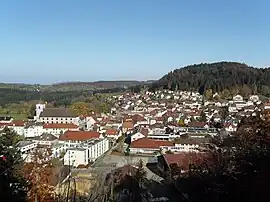 A general view of Maîche | |
.svg.png.webp) Coat of arms | |
Location of Maîche | |
 Maîche  Maîche | |
| Coordinates: 47°15′07″N 6°48′16″E | |
| Country | France |
| Region | Bourgogne-Franche-Comté |
| Department | Doubs |
| Arrondissement | Montbéliard |
| Canton | Maîche |
| Intercommunality | Pays de Maîche |
| Government | |
| • Mayor (2020–2026) | Régis Ligier[1] |
| Area 1 | 17.42 km2 (6.73 sq mi) |
| Population | 4,259 |
| • Density | 240/km2 (630/sq mi) |
| Time zone | UTC+01:00 (CET) |
| • Summer (DST) | UTC+02:00 (CEST) |
| INSEE/Postal code | 25356 /25120 |
| Elevation | 729–981 m (2,392–3,219 ft) |
| 1 French Land Register data, which excludes lakes, ponds, glaciers > 1 km2 (0.386 sq mi or 247 acres) and river estuaries. | |
Geography
Maîche is situated between the rivers Doubs and Dessoubre. It is surrounded by evergreen forests. The highest point in the commune is the Faux Verger.
Population
| Year | Pop. | ±% p.a. |
|---|---|---|
| 1968 | 3,714 | — |
| 1975 | 4,381 | +2.39% |
| 1982 | 4,216 | −0.55% |
| 1990 | 4,168 | −0.14% |
| 1999 | 3,978 | −0.52% |
| 2007 | 4,076 | +0.30% |
| 2012 | 4,331 | +1.22% |
| 2017 | 4,286 | −0.21% |
| Source: INSEE[3] | ||
See also
References
- "Répertoire national des élus: les maires". data.gouv.fr, Plateforme ouverte des données publiques françaises (in French). 2 December 2020.
- "Populations légales 2020". The National Institute of Statistics and Economic Studies. 29 December 2022.
- Population en historique depuis 1968, INSEE
External links
Wikimedia Commons has media related to Maîche.
- Official website (in French)
- Maîche on the intercommunal Web site of the department (in French)
This article is issued from Wikipedia. The text is licensed under Creative Commons - Attribution - Sharealike. Additional terms may apply for the media files.