Macharen
Macharen is a village in the southern part of the Netherlands, in the province North Brabant. It is part of the Oss municipality.
Macharen | |
|---|---|
Village | |
 | |
 Macharen Location in the province of North Brabant in the Netherlands  Macharen Macharen (Netherlands) | |
| Coordinates: 51°48′18″N 5°32′39″E | |
| Country | Netherlands |
| Province | North Brabant |
| Municipality | Oss |
| Area | |
| • Total | 0.86 km2 (0.33 sq mi) |
| Elevation | 8 m (26 ft) |
| Population (2021)[1] | |
| • Total | 655 |
| • Density | 760/km2 (2,000/sq mi) |
| Time zone | UTC+1 (CET) |
| • Summer (DST) | UTC+2 (CEST) |
| Postal code | 5367[1] |
| Dialing code | 0412 |
The village was first mentioned in 1107 as Machera, and means "suitable sandy ridge".[3]
The Catholic St Petrus Bandenkerk was built between 1862 and 1867, however the tower dates from the 15th century.[4]
Macharen was home to 389 people in 1840.[4] Macharen originally was a part of the county Megen, which was founded around 1145. In 1810, it became municipality together with Megen and Haren. It became a part of the municipality Oss in 1994.[4]
Gallery
 Clergy house
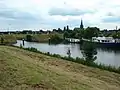 View on Macharen
 Bridge in Macharen
References
- "Kerncijfers wijken en buurten 2021". Central Bureau of Statistics. Retrieved 18 April 2022.
- "Postcodetool for 5367AA". Actueel Hoogtebestand Nederland (in Dutch). Het Waterschapshuis. Retrieved 18 April 2022.
- "Macharen - (geografische naam)". Etymologiebank (in Dutch). Retrieved 18 April 2022.
- "Macharen". Plaatsengids (in Dutch). Retrieved 18 April 2022.
This article is issued from Wikipedia. The text is licensed under Creative Commons - Attribution - Sharealike. Additional terms may apply for the media files.