Provodovice
Provodovice is a municipality and village in Přerov District in the Olomouc Region of the Czech Republic. It has about 200 inhabitants.
Provodovice | |
|---|---|
 Cross by the main road | |
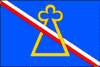 Flag 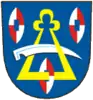 Coat of arms | |
 Provodovice Location in the Czech Republic | |
| Coordinates: 49°27′3″N 17°46′6″E | |
| Country | |
| Region | Olomouc |
| District | Přerov |
| First mentioned | 1302 |
| Area | |
| • Total | 3.28 km2 (1.27 sq mi) |
| Elevation | 355 m (1,165 ft) |
| Population (2023-01-01)[1] | |
| • Total | 157 |
| • Density | 48/km2 (120/sq mi) |
| Time zone | UTC+1 (CET) |
| • Summer (DST) | UTC+2 (CEST) |
| Postal code | 753 53 |
| Website | www |
Etymology
The name is derived from the personal name Provod, meaning "the village of Provod's people".[2]
Geography
Provodovice is located about 22 km (14 mi) west of Přerov and 39 km (24 mi) southeast of Olomouc. It lies in the Moravian-Silesian Foothills. The highest point is at 392 m (1,286 ft) above sea level. The Juhyně Stream flows along the western and northern municipal border.
History
The first written mention of Provodovice is from 1302.[2]
Sights
There are no protected cultural monuments in the municipality.[3] The only landmarks are two wayside crosses and a statue of Saint John of Nepomuk.[2]
References
- "Population of Municipalities – 1 January 2023". Czech Statistical Office. 2023-05-23.
- "Zakladní charakteristika obce" (in Czech). Obec Provodovice. Retrieved 2022-10-11.
- "Výsledky vyhledávání: Kulturní památky, obec Provodovice". Ústřední seznam kulturních památek (in Czech). National Heritage Institute. Retrieved 2023-08-17.
This article is issued from Wikipedia. The text is licensed under Creative Commons - Attribution - Sharealike. Additional terms may apply for the media files.