Thornton Bay
Thornton Bay is a settlement on the west coast of the Coromandel Peninsula of New Zealand, between Te Puru to the north and Whakatete Bay to the south. State Highway 25 runs through it.[3] Ngarimu Bay immediately to the south is considered to be part of the same urban area by Statistics New Zealand.
Thornton Bay | |
|---|---|
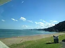
 Bench seat at Thornton Bay | |
| Coordinates: 37.063°S 175.524°E | |
| Country | New Zealand |
| Region | Waikato |
| District | Thames-Coromandel District |
| Ward | Thames ward |
| Community Board | Thames Community |
| Electorates | |
| Government | |
| • Council | Thames-Coromandel District Council |
| Area | |
| • Total | 0.95 km2 (0.37 sq mi) |
| Population (June 2023)[2] | |
| • Total | 330 |
| • Density | 350/km2 (900/sq mi) |
Thornton's Bay was named for R. Thornton, an orchardist who settled in the area in 1890.[4] Ngarimu Bay is named after Moana-Nui-a-Kiwa Ngarimu, the first Māori person to be awarded the Victoria Cross.[5]
Demographics
Thornton Bay-Ngārimu Bay is described by Statistics New Zealand as a rural settlement. It covers 0.95 km2 (0.37 sq mi)[1] and had an estimated population of 330 as of June 2023,[2] with a population density of 347 people per km2. Thornton Bay-Ngārimu Bay is part of the larger Thames Coast statistical area.[6]
| Year | Pop. | ±% p.a. |
|---|---|---|
| 2006 | 312 | — |
| 2013 | 273 | −1.89% |
| 2018 | 309 | +2.51% |
| Source: [7] | ||
Thornton Bay-Ngārimu Bay had a population of 309 at the 2018 New Zealand census, an increase of 36 people (13.2%) since the 2013 census, and a decrease of 3 people (−1.0%) since the 2006 census. There were 150 households, comprising 156 males and 153 females, giving a sex ratio of 1.02 males per female, with 21 people (6.8%) aged under 15 years, 27 (8.7%) aged 15 to 29, 129 (41.7%) aged 30 to 64, and 126 (40.8%) aged 65 or older.[7]
Ethnicities were 97.1% European/Pākehā, 8.7% Māori, 1.0% Pacific peoples, 2.9% Asian, and 1.9% other ethnicities. People may identify with more than one ethnicity.[7]
Although some people chose not to answer the census's question about religious affiliation, 46.6% had no religion, 38.8% were Christian and 1.9% had other religions.[7]
Of those at least 15 years old, 66 (22.9%) people had a bachelor's or higher degree, and 48 (16.7%) people had no formal qualifications. 45 people (15.6%) earned over $70,000 compared to 17.2% nationally. The employment status of those at least 15 was that 99 (34.4%) people were employed full-time, 54 (18.8%) were part-time, and 9 (3.1%) were unemployed.[7]
References
- "ArcGIS Web Application". statsnz.maps.arcgis.com. Retrieved 1 September 2022.
- "Subnational population estimates (RC, SA2), by age and sex, at 30 June 1996-2023 (2023 boundaries)". Statistics New Zealand. Retrieved 25 October 2023. (regional councils); "Subnational population estimates (TA, SA2), by age and sex, at 30 June 1996-2023 (2023 boundaries)". Statistics New Zealand. Retrieved 25 October 2023. (territorial authorities); "Subnational population estimates (urban rural), by age and sex, at 30 June 1996-2023 (2023 boundaries)". Statistics New Zealand. Retrieved 25 October 2023. (urban areas)
- Harriss, Gavin (March 2022). "NZ Topo Map" (Map). Thornton Bay, Waikato.
- Discover New Zealand - A Wises Guide (9th ed.). Wises Publications. 1994. p. 146.
- Monin, Paul (15 December 2010). "Thames—Thames Coast". Te Ara: The Encyclopedia of New Zealand.
- 2018 Census place summary: Thames Coast
- "Statistical area 1 dataset for 2018 Census". Statistics New Zealand. March 2020. 7010692 and 7010695.